
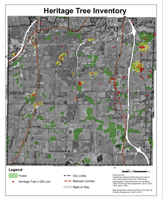
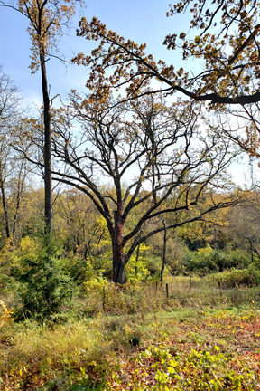
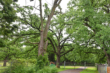
In 1976 as part of the bicentennial celebrations, Walter Scott from the Wisconsin State Department of Natural Resources lead a survey to find trees in an 8-mile radius of the state capital that were estimated to be at least 200 years old. The Fitchburg Parks, Recreation and Forestry Department had identified the original old trees in Fitchburg and is working to identify new trees that meet the age requirement as well as to identify the old trees that are no longer standing. The 200 plus year old trees have been called Heritage Trees and are identified by their circumference at 4.5 feet above ground level. White and bur oaks need a trunk circumference of at least 10 feet. Pin, black and red oaks need a circumference of at least 11 feet. As of several years ago they had identified 115 trees of this age or older.
Since old trees are part of our Fitchburg heritage, the Fitchburg Historical Society has developed a new project to help the Fitchburg Parks, Recreation and Forestry Department update their records and establish which of the old Heritage Trees are still standing, identify other trees that are over 200 years old and take photographs of as many of the Heritage Trees as possible.
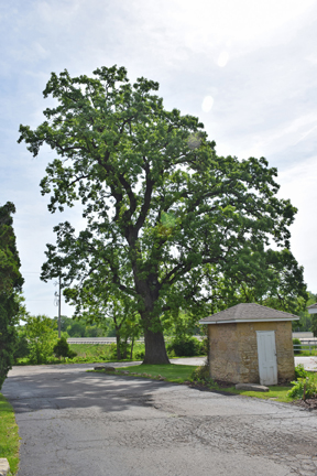
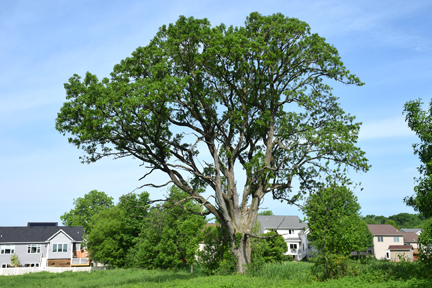
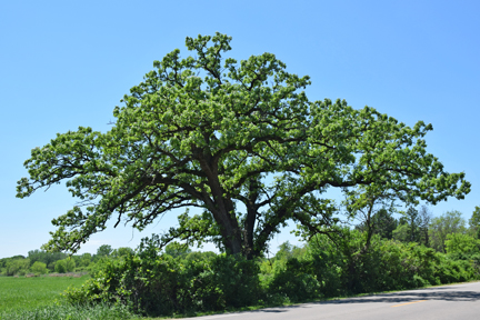
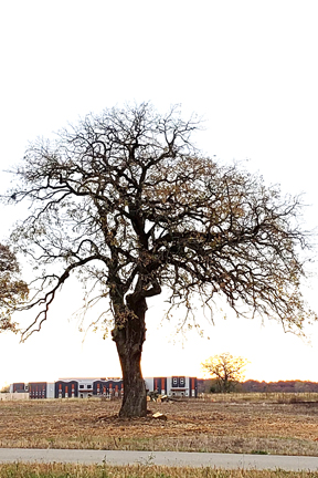
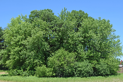
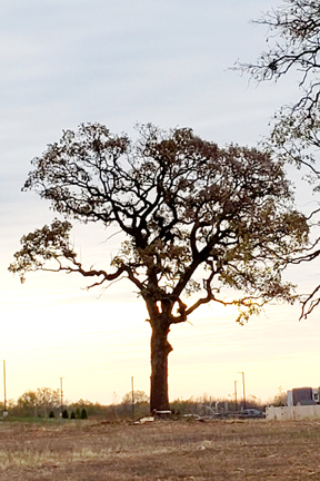
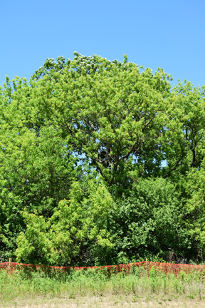
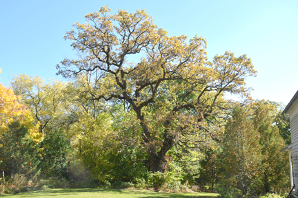
The city developed a map showing the locations of the Heritage and Specimen Trees in Fitchburg. We have modified this map to show only the Heritage Trees (see below) and are placing a number on the map by each Heritage Tree that is still standing. The numbered list below has links to 2020 photographs of the trees. We are requesting FHS members and anyone interested to use this map to 1) help identify those Heritage Trees that have been cut down (will place an X on the map); 2) take photographs of the Heritage Trees that are still standing (the city does not have photographs of the old Heritage Trees); and 3) to identify new Heritage Trees in Fitchburg. This information is being shared with the city.
If you have questions, information and/or photographs of Heritage Trees or think you have identified a 200 plus year old tree please contact the Fitchburg Historical Society at Woodedarchives@gmail.com The map below can be downloaded and enlarged to better identify the locations of the Heritage Trees.
Numbered trees with links to tree photographs
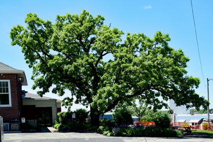
- Tree 1 at Fitchburg Serenity Club, PD and Spoke; 43o 00′ 57.06” N 89o 27′ 49.54” W
- Tree 2 at Fitchburg Serenity Club, PD and Spoke; 43o 00′ 56.31” N 89o 27′ 48.53” W
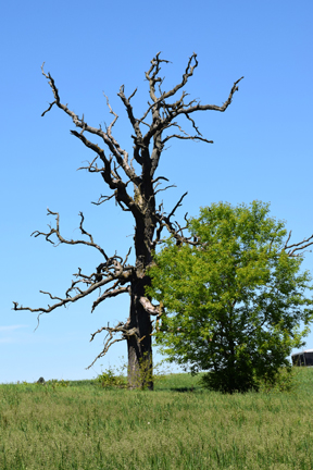
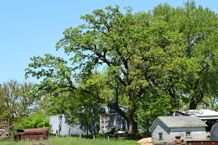
- Tree 1 on Vroman Farmstead, Seminole and Vroman Rd (dead but still standing); 42o 59′ 05.77” N 89o 27′ 51.60” W
- Tree 2 on Vroman Farmstead, Seminole and Vroman Rd; 42o 59′ 06.44” N 89o 27′ 49.75” W
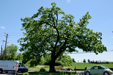
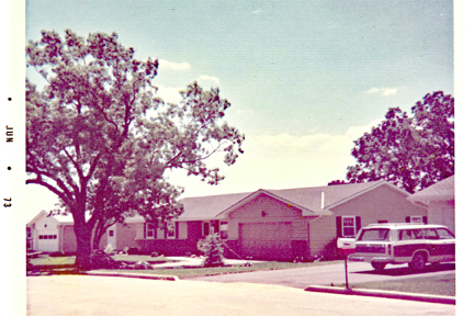
- Tree 1 on Pembroke Dr west of Raritan Rd June 1973 photo; 43o 00′ 28.16” N 89o 26′ 27.57” W
- Tree 2 on Pembroke Dr west of Raritan Rd, in back yard July 1972 photo; 43o 00′ 27.00” N 89o 26′ 27.56” W
- Tree in Oak Meadow Park, between Targhee St and Saw-tooth Dr; 42o 59′ 51.26” N 89o 25′ 56.26” W
- Tree behind Quivey’s Grove stone house on Nesbitt Rd; 43o 00′ 33.14” N 89o 28′ 42.76” W
- Tree 1 (west) on south end of Quarry Hill Park by Quarry Hill Dr.; 42o 59′ 52.46” N 89o 24′ 57.16” W
- Tree 2 (east) on south end of Quarry Hill Park by Quarry Hill Dr.; 42o 59′ 52.52” N 89o 24′ 55.53” W
- Tree off of Fish Hatchery Rd and south of Noble Dr., cannot see from road
- Tree 1 on south side of Whalen Rd east of Seminole Dr.; 42o 58′ 45.79” N 89o 27′ 37.46” W
- Tree 2 on north side of Whalen Rd east of Seminole Dr.42o 58′ 46.53” N 89o 27′ 36.02” W
- Tree 1 on east side MM north of Lacy junction; 43o 00′ 47.79” N 89o 22′ 29.59” W
- Tree 2 on east side MM north of Lacy junction 11/20/2016 photo tree 2; 43o 00′ 50.53” N 89o 22′ 29.39” W
- Tree 3 on east side MM north of Lacy junction; 43o 00′ 48.35” N 89o 22′ 27.24” W
- Tree 4 on east side MM north of Lacy junction; 43o 00′ 50.75” N 89o 22′ 23.64” W
- Tree 5 on east side MM north of Lacy junction; 43o 00′ 49.91” N 89o 22′ 23.64” W
- Tree 1 northwest of Haight Farm Rd and MM; 43o 00′ 09.74” N 89o 22′ 39.16” W
- Tree 2 northwest of Haight Farm Rd and MM; 43o 00′ 08.86” N 89o 22′ 39.90” W
- Tree 3 northwest of Haight Farm Rd and MM; 43o 00′ 07.31” N 89o 22′ 43.36” W
- Tree 4 northwest of Haight Farm Rd and MM; 43o 00′ 06.74” N 89o 22′ 42.56” W
- Tree northwest of Haight Farm Rd and MM; 43o 00′ 09.03” N 89o 22′ 36.29” W
New Potential Heritage Trees
- Fish Hatchery tree north of Fish Hatchery building by service gate; 43o 01′ 01.60″ N 89o 25′ 07.26″ W
- Ledgemont St tree north of Raritan Rd in back yard; 43o 00′ 18.76” N 89o 26′ 37.83” W
- Pembroke Dr tree west of Raritan Rd; 43o 00′ 31.77” N 89o 26′ 29.11” W
